
双河镇 topographic map
Interactive map
Click on the map to display elevation.
About this map
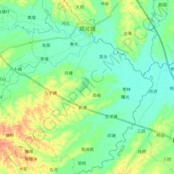
Name: 双河镇 topographic map, elevation, terrain.
Location: 双河镇, 金安区, 六安市, 安徽省, 中国 (31.45166 116.70894 31.57203 116.83369)
Average elevation: 98 ft
Minimum elevation: 49 ft
Maximum elevation: 197 ft
Other topographic maps
Click on a map to view its topography, its elevation and its terrain.