
Simrishamn topographic map
Interactive map
Click on the map to display elevation.
About this map
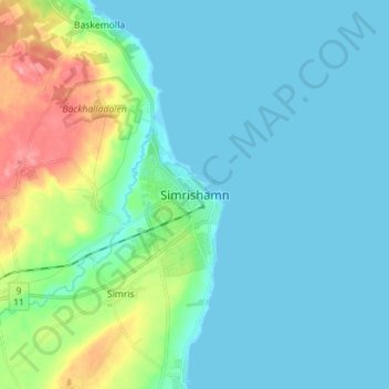
Name: Simrishamn topographic map, elevation, terrain.
Location: Simrishamn, Comté de Scanie, Götaland, 27231, Suède (55.51655 14.30999 55.59655 14.38999)
Average elevation: 56 ft
Minimum elevation: -7 ft
Maximum elevation: 272 ft