
Chananeille topographic map
Interactive map
Click on the map to display elevation.
About this map
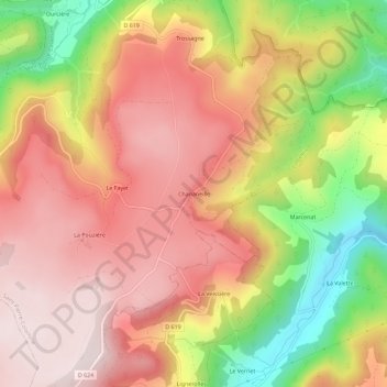
Name: Chananeille topographic map, elevation, terrain.
Average elevation: 3,337 ft
Minimum elevation: 2,306 ft
Maximum elevation: 4,012 ft
Other topographic maps
Click on a map to view its topography, its elevation and its terrain.
Trossagne
Frankreich > Auvergne-Rhone-Alpen > Puy-de-Dôme > Saint-Pierre-Colamine > Lomprat
Trossagne, Lomprat, Saint-Pierre-Colamine, Issoire, Puy-de-Dôme, Auvergne-Rhone-Alpen, Metropolitanes Frankreich, 63610, Frankreich
Average elevation: 3,061 ft