
Gornergrat topographic map
Interactive map
Click on the map to display elevation.
About this map
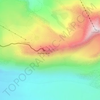
Name: Gornergrat topographic map, elevation, terrain.
Average elevation: 9,081 ft
Minimum elevation: 7,982 ft
Maximum elevation: 10,755 ft
Other topographic maps
Click on a map to view its topography, its elevation and its terrain.
Monte Rosa
Switzerland > Wallis > Visp > Zermatt
Monte Rosa, Zermatt, Visp, Wallis, 3920, Switzerland
Average elevation: 13,232 ft
Matterhorn
Switzerland > Wallis > Visp > Zermatt
Matterhorn, Zermatt, Visp, Wallis, 3920, Switzerland
Average elevation: 10,810 ft