Geolocate

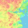
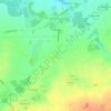
Ullerslev topographic map

Click on the map to display elevation.

About this map

Name: Ullerslev topographic map, elevation, terrain.

Location: Ullerslev, Nyborg Municipality, Region of Southern Denmark, 5540, Denmark (55.34153 10.64305 55.38153 10.68305)

Average elevation: 49 ft

Minimum elevation: 10 ft

Maximum elevation: 89 ft

Other topographic maps

Click on a map to view its topography, its elevation and its terrain.
Funen

Denmark > Region of Southern Denmark

Average elevation: 62 ft

Funen

Denmark > Region of Southern Denmark

Average elevation: 62 ft

Funen

Denmark > Region of Southern Denmark

Average elevation: 62 ft

Fanø

Denmark > Region of Southern Denmark > Sønderho

Average elevation: 3 ft

Rømø

Denmark > Region of Southern Denmark

Average elevation: 0 ft

Funen

Denmark > Region of Southern Denmark

Average elevation: 62 ft

Skarø

Denmark > Region of Southern Denmark

Average elevation: 0 ft

Guldbjerg

Denmark > Region of Southern Denmark

Average elevation: 75 ft

Egholm

Denmark > Region of Southern Denmark

Average elevation: 0 ft

Funen

Denmark > Region of Southern Denmark

Average elevation: 62 ft

Ærø

Denmark > Region of Southern Denmark

Average elevation: 10 ft

Funen

Denmark > Region of Southern Denmark

Average elevation: 62 ft

Gear up for your next adventure:

🛡️Bear Spray Outdoor - Protection in bear country hikes
🪶Multi‑Purpose Knife - Useful blade for camp and trail
🕶️Glacier Sunglasses - Side shields to protect eyes from high-altitude snow glare
🧭GPS Watch Accessories - Bands and chargers for GPS watches
🧭Orienteering Set - Complete compass and map reading kit

As an Amazon Associate, this site earns from qualifying purchases at no extra cost to you.