
Parada de Sil topographic map
Interactive map
Click on the map to display elevation.
About this map
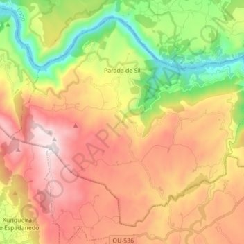
Name: Parada de Sil topographic map, elevation, terrain.
Location: Parada de Sil, Terra de Caldelas, Ourense, Galicië, Spanje (42.31714 -7.63353 42.40487 -7.49513)
Average elevation: 2,464 ft
Minimum elevation: 656 ft
Maximum elevation: 4,304 ft