
古荣镇 topographic map
Interactive map
Click on the map to display elevation.
About this map
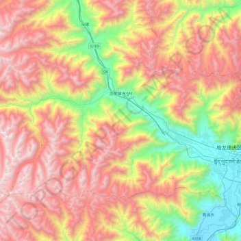
Name: 古荣镇 topographic map, elevation, terrain.
Location: 古荣镇, 堆龙德庆区, 拉萨市, 西藏自治区, 中国 (29.56862 90.46844 29.83759 90.91873)
Average elevation: 15,499 ft
Minimum elevation: 11,841 ft
Maximum elevation: 19,344 ft