
Chancal topographic map
Interactive map
Click on the map to display elevation.
About this map
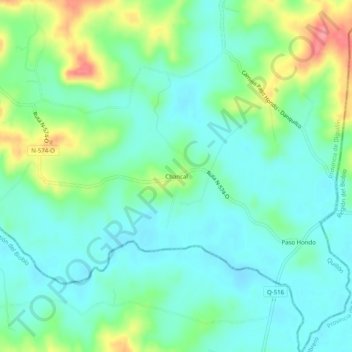
Name: Chancal topographic map, elevation, terrain.
Average elevation: 407 ft
Minimum elevation: 325 ft
Maximum elevation: 614 ft
Other topographic maps
Click on a map to view its topography, its elevation and its terrain.
Cerro Cayumanqui
Chile > Región de Ñuble > Provincia de Diguillín > Quillón
Cerro Cayumanqui, Quillón, Provincia de Diguillín, Región de Ñuble, Chile
Average elevation: 1,693 ft