
Cabeceiras de Basto topographic map
Interactive map
Click on the map to display elevation.
About this map
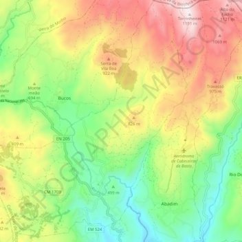
Name: Cabeceiras de Basto topographic map, elevation, terrain.
Location: Cabeceiras de Basto, Braga, Portugal (41.52788 -8.06890 41.60314 -7.98261)
Average elevation: 2,231 ft
Minimum elevation: 991 ft
Maximum elevation: 3,888 ft