
凤凰路街道 topographic map
Interactive map
Click on the map to display elevation.
About this map
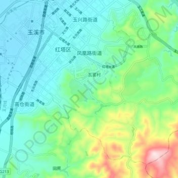
Name: 凤凰路街道 topographic map, elevation, terrain.
Location: 凤凰路街道, 红塔区, 玉溪市, 云南省, 中国 (24.29734 102.52688 24.35844 102.60597)
Average elevation: 5,682 ft
Minimum elevation: 5,305 ft
Maximum elevation: 6,880 ft