
Zona 4 de Villa Nueva topographic map
Interactive map
Click on the map to display elevation.
About this map
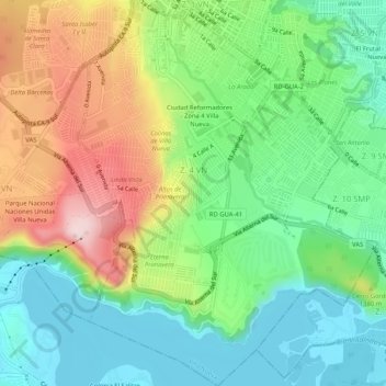
Name: Zona 4 de Villa Nueva topographic map, elevation, terrain.
Average elevation: 4,318 ft
Minimum elevation: 3,885 ft
Maximum elevation: 5,079 ft
Other topographic maps
Click on a map to view its topography, its elevation and its terrain.
Zona 12 de Villa Nueva
Guatemala > Guatemala Department > Villa Nueva City
Zona 12 de Villa Nueva, Villa Nueva City, Guatemala Department, 01064, Guatemala
Average elevation: 4,541 ft