
M'Naguer topographic map
Interactive map
Click on the map to display elevation.
About this map
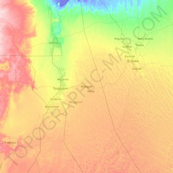
Name: M'Naguer topographic map, elevation, terrain.
Location: M'Naguer, Daïra Taïbet, Touggourt, Algérie (32.32888 6.00530 33.91496 6.41312)
Average elevation: 312 ft
Minimum elevation: -95 ft
Maximum elevation: 784 ft