
Meribel-les-Allues topographic map
Interactive map
Click on the map to display elevation.
About this map
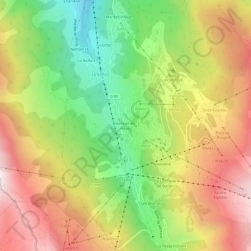
Name: Meribel-les-Allues topographic map, elevation, terrain.
Average elevation: 5,643 ft
Minimum elevation: 3,911 ft
Maximum elevation: 7,421 ft
Other topographic maps
Click on a map to view its topography, its elevation and its terrain.
Le Châtelet
France > Auvergne-Rhône-Alpes > Savoy > Les Allues
Le Châtelet, Les Allues, Albertville, Savoy, Auvergne-Rhône-Alpes, Metropolitan France, 73550, France
Average elevation: 6,706 ft