
Tafraoute topographic map
Interactive map
Click on the map to display elevation.
About this map
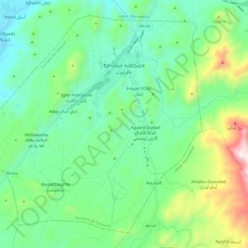
Name: Tafraoute topographic map, elevation, terrain.
Average elevation: 3,829 ft
Minimum elevation: 2,756 ft
Maximum elevation: 6,696 ft
Tafraoute liegt inmitten einer imposanten Granitlandschaft im westlichen Antiatlas am Oued Massa in einer Höhe von ca. 1000 m. Die Entfernung von Agadir beträgt etwa 160 km (R105 über Aït Baha) bzw. 195 km (N1 und R104 über Tiznit). Das Klima ist wegen der Höhenlage eher gemäßigt; der spärliche Regen (ca. 235 mm/Jahr) fällt nahezu ausschließlich in den Wintermonaten.