
Pyla-sur-Mer topographic map
Interactive map
Click on the map to display elevation.
About this map
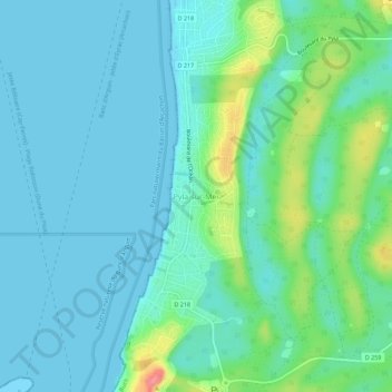
Name: Pyla-sur-Mer topographic map, elevation, terrain.
Average elevation: 59 ft
Minimum elevation: 0 ft
Maximum elevation: 282 ft
Other topographic maps
Click on a map to view its topography, its elevation and its terrain.
Dune du Pilat
France > Nouvelle-Aquitaine > Gironde > La Teste-de-Buch
Dune du Pilat, La Teste-de-Buch, Arcachon, Gironde, Nouvelle-Aquitaine, France métropolitaine, 33115, France
Average elevation: 75 ft