
Gerasdorf bei Wien topographic map
Interactive map
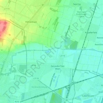
Click on the map to display elevation.
About this map
Name: Gerasdorf bei Wien topographic map, elevation, terrain.
Average elevation: 554 ft
Minimum elevation: 499 ft
Maximum elevation: 735 ft
Other topographic maps
Click on a map to view its topography, its elevation and its terrain.
Föhrenhain
Österreich > Niederösterreich > Bezirk Korneuburg > Gemeinde Gerasdorf bei Wien
Föhrenhain, Gemeinde Gerasdorf bei Wien, Bezirk Korneuburg, Niederösterreich, 2101, Österreich
Average elevation: 597 ft