
La Rouquette topographic map
Interactive map
Click on the map to display elevation.
About this map
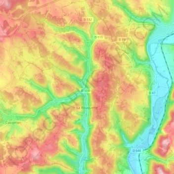
Name: La Rouquette topographic map, elevation, terrain.
Average elevation: 1,115 ft
Minimum elevation: 761 ft
Maximum elevation: 1,460 ft
Other topographic maps
Click on a map to view its topography, its elevation and its terrain.
Bros
France > Occitanie > La Rouquette > Bros
Bros, La Rouquette, Villefranche-de-Rouergue, Aveyron, Occitanie, France métropolitaine, 12200, France
Average elevation: 1,198 ft