
Castroverde de Campos topographic map
Interactive map
Click on the map to display elevation.
About this map
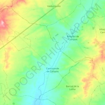
Name: Castroverde de Campos topographic map, elevation, terrain.
Location: Castroverde de Campos, Zamora, Castile and León, 49110, Spain (41.93747 -5.41217 42.04211 -5.25440)
Average elevation: 2,425 ft
Minimum elevation: 2,277 ft
Maximum elevation: 2,733 ft