Varennes-en-Argonne topographic map
Interactive map
Click on the map to display elevation.
About this map
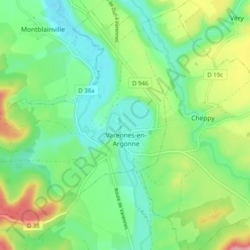
Name: Varennes-en-Argonne topographic map, elevation, terrain.
Average elevation: 610 ft
Minimum elevation: 466 ft
Maximum elevation: 902 ft

Click on the map to display elevation.
Name: Varennes-en-Argonne topographic map, elevation, terrain.
Average elevation: 610 ft
Minimum elevation: 466 ft
Maximum elevation: 902 ft