
La Muse topographic map
Interactive map
Click on the map to display elevation.
About this map
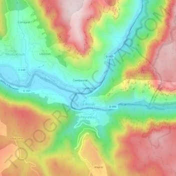
Name: La Muse topographic map, elevation, terrain.
Average elevation: 2,051 ft
Minimum elevation: 1,250 ft
Maximum elevation: 3,012 ft
Other topographic maps
Click on a map to view its topography, its elevation and its terrain.
Combaurie
France > Occitanie > Aveyron > Mostuéjouls
Combaurie, Mostuéjouls, Millau, Aveyron, Occitanie, France métropolitaine, 12720, France
Average elevation: 2,018 ft
Liaucous
France > Occitanie > Aveyron > Mostuéjouls
Liaucous, Mostuéjouls, Millau, Aveyron, Occitanie, France métropolitaine, 12720, France
Average elevation: 2,008 ft