
Thank you for supporting this site ❤️
Make a donation
Make a donation
Gear up for your next adventure:
As an Amazon Associate, this site earns from qualifying purchases at no extra cost to you.
Cantonment topographic map
Click on the map to display elevation.
Thank you for supporting this site ❤️
Make a donation
Make a donation
Gear up for your next adventure:
As an Amazon Associate, this site earns from qualifying purchases at no extra cost to you.
About this map
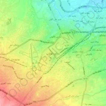
Name: Cantonment topographic map, elevation, terrain.
Location: Cantonment, Khyber Pakhtunkhwa, 250000, Pakistan (33.95860 71.49383 34.03860 71.57383)
Average elevation: 1,155 ft
Minimum elevation: 1,014 ft
Maximum elevation: 1,335 ft
Thank you for supporting this site ❤️
Make a donation
Make a donation
Gear up for your next adventure:
As an Amazon Associate, this site earns from qualifying purchases at no extra cost to you.