
Jesús María Garza topographic map
Interactive map
Click on the map to display elevation.
About this map
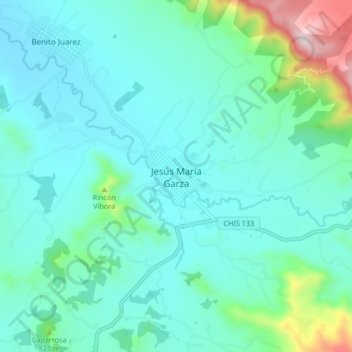
Name: Jesús María Garza topographic map, elevation, terrain.
Location: Jesús María Garza, Villaflores, Chiapas, México (16.35529 -93.33257 16.43529 -93.25257)
Average elevation: 2,323 ft
Minimum elevation: 1,939 ft
Maximum elevation: 4,170 ft
Other topographic maps
Click on a map to view its topography, its elevation and its terrain.