
Thank you for supporting this site ❤️
Make a donation
Make a donation
Gear up for your next adventure:
As an Amazon Associate, this site earns from qualifying purchases at no extra cost to you.
النحلي topographic map
Click on the map to display elevation.
Thank you for supporting this site ❤️
Make a donation
Make a donation
Gear up for your next adventure:
As an Amazon Associate, this site earns from qualifying purchases at no extra cost to you.
About this map
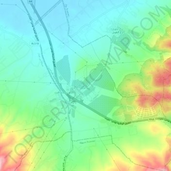
Name: النحلي topographic map, elevation, terrain.
Location: النحلي, معتمدية قلعة الأندلس, Ariana, 2094, Tunisia (36.87904 10.10474 36.92440 10.15424)
Average elevation: 223 ft
Minimum elevation: 20 ft
Maximum elevation: 699 ft
Thank you for supporting this site ❤️
Make a donation
Make a donation
Gear up for your next adventure:
As an Amazon Associate, this site earns from qualifying purchases at no extra cost to you.