Geolocate

Warrior topographic map

Click on the map to display elevation.

About this map

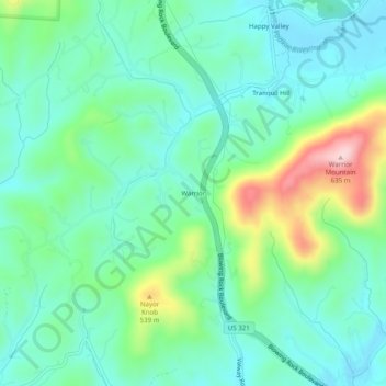
Name: Warrior topographic map, elevation, terrain.

Location: Warrior, Lenoir, Caldwell County, North Carolina, United States (35.95139 -81.58841 35.99139 -81.54841)

Average elevation: 1,414 ft

Minimum elevation: 1,181 ft

Maximum elevation: 2,073 ft

Caldwell County trails, hiking, mountain biking, running and outdoor activities

Gear up for your next adventure:

🧭GPS Watch Accessories - Bands and chargers for GPS watches
🛰️Handheld GPS Units - Professional satellite navigators for precise backcountry mapping
🌧️Backpack Rain Cover - Keep gear dry in wet weather
📷Action Cameras - Rugged cameras to document your journeys across rugged terrain
🧢Outdoor Hiking Hat - Sun protection hat for outdoor explorers

As an Amazon Associate, this site earns from qualifying purchases at no extra cost to you.