
Naundorf topographic map
Interactive map
Click on the map to display elevation.
About this map
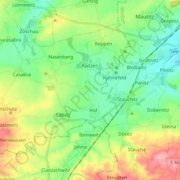
Name: Naundorf topographic map, elevation, terrain.
Location: Naundorf, Nordsachsen, Saxony, Germany (51.21944 13.08848 51.27907 13.21729)
Average elevation: 509 ft
Minimum elevation: 381 ft
Maximum elevation: 719 ft