
Thank you for supporting this site ❤️
Make a donation
Make a donation
Gear up for your next adventure:
As an Amazon Associate, this site earns from qualifying purchases at no extra cost to you.
Habanero topographic map
Click on the map to display elevation.
Thank you for supporting this site ❤️
Make a donation
Make a donation
Gear up for your next adventure:
As an Amazon Associate, this site earns from qualifying purchases at no extra cost to you.
About this map
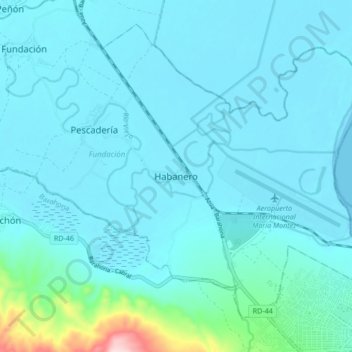
Name: Habanero topographic map, elevation, terrain.
Location: Habanero, Fundación, Barahona Province, Dominican Republic (18.21677 -71.18688 18.29677 -71.10688)
Average elevation: 98 ft
Minimum elevation: -3 ft
Maximum elevation: 1,010 ft
Thank you for supporting this site ❤️
Make a donation
Make a donation
Gear up for your next adventure:
As an Amazon Associate, this site earns from qualifying purchases at no extra cost to you.