
Loch Leven topographic map
Interactive map
Click on the map to display elevation.
About this map
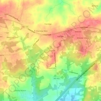
Name: Loch Leven topographic map, elevation, terrain.
Location: Loch Leven, Harford County, Maryland, USA (39.54594 -76.19051 39.58594 -76.15051)
Average elevation: 351 ft
Minimum elevation: 200 ft
Maximum elevation: 453 ft