
Thalgau topographic map
Interactive map
Click on the map to display elevation.
About this map
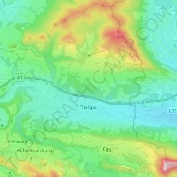
Name: Thalgau topographic map, elevation, terrain.
Location: Thalgau, Salzburg-Umgebung, Salzburg, 5303, Oostenrijk (47.80847 13.18105 47.89260 13.31221)
Average elevation: 2,310 ft
Minimum elevation: 1,650 ft
Maximum elevation: 4,213 ft