
Sidi Medjahed topographic map
Interactive map
Click on the map to display elevation.
About this map
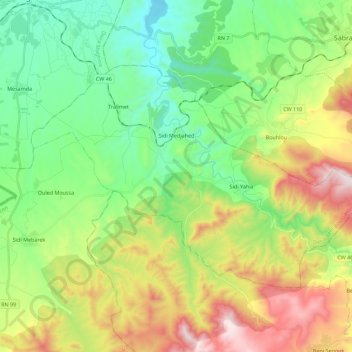
Name: Sidi Medjahed topographic map, elevation, terrain.
Location: Sidi Medjahed, Daïra Beni Boussaid, Tlemcen, Algérie (34.69522 -1.72914 34.81158 -1.50504)
Average elevation: 1,991 ft
Minimum elevation: 932 ft
Maximum elevation: 3,973 ft
Other topographic maps
Click on a map to view its topography, its elevation and its terrain.
Beni Boussaid
Algérie > Tlemcen > Daïra Beni Boussaid
Beni Boussaid, Daïra Beni Boussaid, Tlemcen, Algérie
Average elevation: 2,851 ft
Mohamed Salah
Algérie > Tlemcen > Daïra Beni Boussaid
Mohamed Salah, Beni Boussaid, Daïra Beni Boussaid, Tlemcen, Algérie
Average elevation: 1,857 ft