
كوستي topographic map
Interactive map
Click on the map to display elevation.
About this map
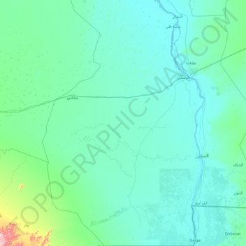
Name: كوستي topographic map, elevation, terrain.
Location: كوستي, Weißer Nil, Sudan (11.95105 31.64664 13.69576 32.82420)
Average elevation: 1,385 ft
Minimum elevation: 1,243 ft
Maximum elevation: 3,694 ft