
Daarle topographic map
Interactive map
Click on the map to display elevation.
About this map
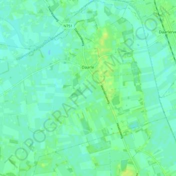
Name: Daarle topographic map, elevation, terrain.
Location: Daarle, Hellendoorn, Overijssel, Niederlande (52.40067 6.49818 52.45123 6.57595)
Average elevation: 30 ft
Minimum elevation: 13 ft
Maximum elevation: 52 ft
Other topographic maps
Click on a map to view its topography, its elevation and its terrain.
Nijverdal
Niederlande > Overijssel > Hellendoorn
Nijverdal, Hellendoorn, Overijssel, Niederlande
Average elevation: 52 ft
Hellendoorn
Niederlande > Overijssel > Hellendoorn
Hellendoorn, Overijssel, Niederlande
Average elevation: 33 ft