
沭阳县 topographic map
Interactive map
Click on the map to display elevation.
About this map
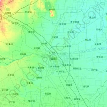
Name: 沭阳县 topographic map, elevation, terrain.
Location: 沭阳县, Suqian, Jiangsu, 223600, China (33.88721 118.49770 34.42186 119.17106)
Average elevation: 39 ft
Minimum elevation: 3 ft
Maximum elevation: 259 ft
Other topographic maps
Click on a map to view its topography, its elevation and its terrain.