
Thank you for supporting this site ❤️
Make a donation
Make a donation
Gear up for your next adventure:
As an Amazon Associate, this site earns from qualifying purchases at no extra cost to you.
Sambong topographic map
Click on the map to display elevation.
Thank you for supporting this site ❤️
Make a donation
Make a donation
Gear up for your next adventure:
As an Amazon Associate, this site earns from qualifying purchases at no extra cost to you.
About this map
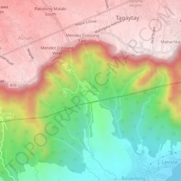
Name: Sambong topographic map, elevation, terrain.
Location: Sambong, Tagaytay, Cavite, Calabarzon, 4120, Philippines (14.06705 120.90367 14.10705 120.94367)
Average elevation: 1,224 ft
Minimum elevation: 13 ft
Maximum elevation: 2,267 ft
Thank you for supporting this site ❤️
Make a donation
Make a donation
Gear up for your next adventure:
As an Amazon Associate, this site earns from qualifying purchases at no extra cost to you.