Geolocate

Mendavia topographic map

Click on the map to display elevation.

About this map

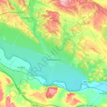
Name: Mendavia topographic map, elevation, terrain.

Location: Mendavia, Estellerria / Tierra Estella, 31587, Spain (42.40777 -2.28802 42.49538 -2.11850)

Average elevation: 1,332 ft

Minimum elevation: 1,047 ft

Maximum elevation: 1,860 ft

Gear up for your next adventure:

🚁Photography Drones - Capture stunning aerial views of landforms and topography
🪑Ultralight Camp Chairs - Portable seating for resting after a long day of mapping
🪵Folding Camp Saw - Compact saw for wood and campsite work
🔦Compact Flashlight - Reliable flashlight for emergencies
📚USA Hiking Guide Books - Top trail guides and map books

As an Amazon Associate, this site earns from qualifying purchases at no extra cost to you.