
Montespluga topographic map
Interactive map
Click on the map to display elevation.
About this map
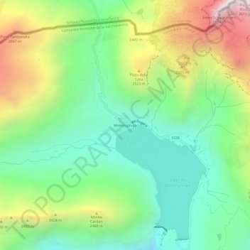
Name: Montespluga topographic map, elevation, terrain.
Average elevation: 7,198 ft
Minimum elevation: 5,735 ft
Maximum elevation: 9,833 ft
Montespluga is an Alpine village near the head of the Valle Spluga in the Italian region of Lombardy. It is a frazione of the comune of Madesimo, located at 1,908 m of altitude on the road to Chiavenna.