
Flushing topographic map
Click on the map to display elevation.
About this map
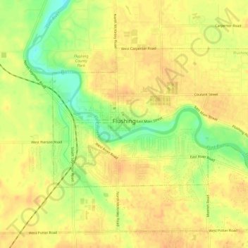
Name: Flushing topographic map, elevation, terrain.
Location: Flushing, Genesee County, Michigan, 48433, United States (43.05022 -83.86688 43.07470 -83.81302)
Average elevation: 722 ft
Minimum elevation: 646 ft
Maximum elevation: 755 ft
Genesee County trails, hiking, mountain biking, running and outdoor activities
Other topographic maps
Click on a map to view its topography, its elevation and its terrain.
Genessee County Recreational Area
United States > Michigan > Genesee County > Genesee Charter Township
Average elevation: 758 ft