
めぐみ町 topographic map
Interactive map
Click on the map to display elevation.
About this map
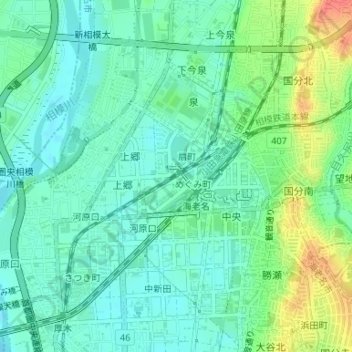
Name: めぐみ町 topographic map, elevation, terrain.
Location: めぐみ町, Ebina, Prefectura de Kanagawa, 243-0438, Japón (35.45093 139.38557 35.45702 139.39564)
Average elevation: 95 ft
Minimum elevation: 39 ft
Maximum elevation: 226 ft