
Thank you for supporting this site ❤️
Make a donation
Make a donation
Gear up for your next adventure:
As an Amazon Associate, this site earns from qualifying purchases at no extra cost to you.
Al-Diwaniyah District topographic map
Click on the map to display elevation.
Thank you for supporting this site ❤️
Make a donation
Make a donation
Gear up for your next adventure:
As an Amazon Associate, this site earns from qualifying purchases at no extra cost to you.
About this map
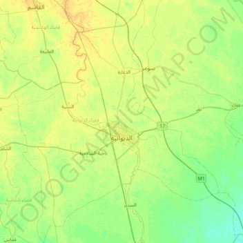
Name: Al-Diwaniyah District topographic map, elevation, terrain.
Location: Al-Diwaniyah District, Al-Qadisiyah Governorate, Iraq (31.73358 44.61787 32.31355 45.19863)
Average elevation: 72 ft
Minimum elevation: 46 ft
Maximum elevation: 98 ft
Thank you for supporting this site ❤️
Make a donation
Make a donation
Gear up for your next adventure:
As an Amazon Associate, this site earns from qualifying purchases at no extra cost to you.