
Thank you for supporting this site ❤️
Make a donation
Make a donation
Gear up for your next adventure:
As an Amazon Associate, this site earns from qualifying purchases at no extra cost to you.
Su Masu/Elmas topographic map
Click on the map to display elevation.
Thank you for supporting this site ❤️
Make a donation
Make a donation
Gear up for your next adventure:
As an Amazon Associate, this site earns from qualifying purchases at no extra cost to you.
About this map
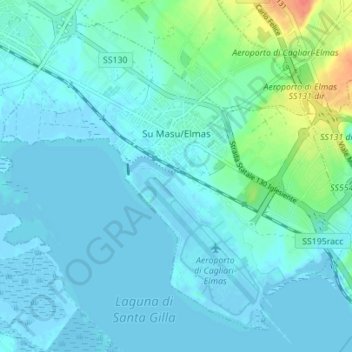
Name: Su Masu/Elmas topographic map, elevation, terrain.
Location: Su Masu/Elmas, Casteddu/Cagliari, Sardinia, 09030, Italy (39.23807 9.01524 39.28485 9.08475)
Average elevation: 26 ft
Minimum elevation: -13 ft
Maximum elevation: 167 ft
Thank you for supporting this site ❤️
Make a donation
Make a donation
Gear up for your next adventure:
As an Amazon Associate, this site earns from qualifying purchases at no extra cost to you.