
Carinerland topographic map
Interactive map
Click on the map to display elevation.
About this map
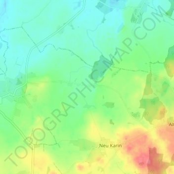
Name: Carinerland topographic map, elevation, terrain.
Average elevation: 157 ft
Minimum elevation: 79 ft
Maximum elevation: 305 ft
Other topographic maps
Click on a map to view its topography, its elevation and its terrain.
Bolland
Deutschland > Mecklenburg-Vorpommern > Bolland
Bolland, Neubukow-Salzhaff, Rostock, Mecklenburg-Vorpommern, Deutschland
Average elevation: 157 ft