
Zahme Leck topographic map
Interactive map
Click on the map to display elevation.
About this map
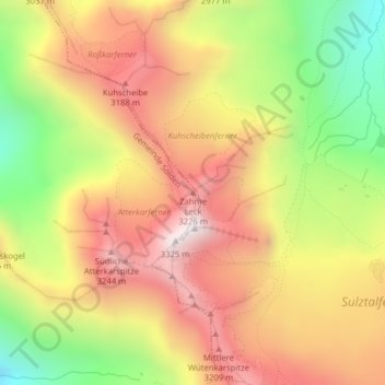
Name: Zahme Leck topographic map, elevation, terrain.
Location: Zahme Leck, Gemeinde Sölden, Bezirk Imst, Tirol, Österreich (47.00517 11.06208 47.00527 11.06218)
Average elevation: 9,334 ft
Minimum elevation: 7,523 ft
Maximum elevation: 10,837 ft