Geolocate

Senheim topographic map

Click on the map to display elevation.

About this map

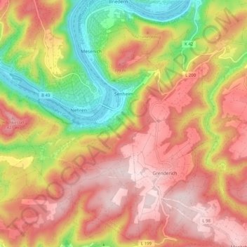
Name: Senheim topographic map, elevation, terrain.

Location: Senheim, Cochem, Landkreis Cochem-Zell, Rhineland-Palatinate, 56858, Germany (50.04663 7.17637 50.10952 7.24686)

Average elevation: 951 ft

Minimum elevation: 272 ft

Maximum elevation: 1,460 ft

Other topographic maps

Click on a map to view its topography, its elevation and its terrain.

Gear up for your next adventure:

🎒Hydration Pack - Hands‑free water reservoir for long hikes
🏕️Tent Footprint - Protect your tent base from wear
🧭Hiking Compass - Precision compass for reliable navigation in the wilderness
👖Convertible Hiking Pants - Versatile zip-off pants for changing altitudes and temperatures
🗃️Trail First Aid Kit - Essential kit for outdoor injuries and emergencies

As an Amazon Associate, this site earns from qualifying purchases at no extra cost to you.