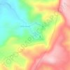
Planaltina topographic map
Click on the map to display elevation.
About this map

Name: Planaltina topographic map, elevation, terrain.
Location: Planaltina, Goiás, Central-West Region, Brazil (-15.50223 -48.10735 -15.01656 -47.46191)
Average elevation: 2,884 ft
Minimum elevation: 1,660 ft
Maximum elevation: 4,236 ft
Other topographic maps
Click on a map to view its topography, its elevation and its terrain.


Rosa
Brazil > Goiás > Região Integrada de Desenvolvimento do Distrito Federal e Entorno > Pirenópolis
Average elevation: 2,559 ft

Bom Jesus
Brazil > Goiás > Região Integrada de Desenvolvimento do Distrito Federal e Entorno > Pirenópolis
Average elevation: 2,493 ft