
Thank you for supporting this site ❤️
Make a donation
Make a donation
Gear up for your next adventure:
As an Amazon Associate, this site earns from qualifying purchases at no extra cost to you.
Arnsdorf topographic map
Click on the map to display elevation.
Thank you for supporting this site ❤️
Make a donation
Make a donation
Gear up for your next adventure:
As an Amazon Associate, this site earns from qualifying purchases at no extra cost to you.
About this map
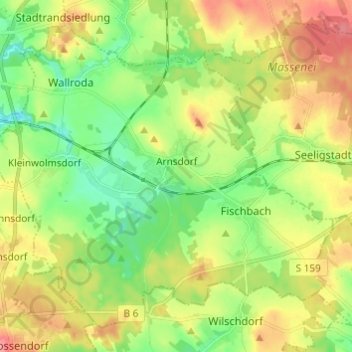
Name: Arnsdorf topographic map, elevation, terrain.
Location: Arnsdorf, Bautzen - Budyšin, Saxony, 01477, Germany (51.06086 13.92593 51.12663 14.04729)
Average elevation: 892 ft
Minimum elevation: 774 ft
Maximum elevation: 1,050 ft
Thank you for supporting this site ❤️
Make a donation
Make a donation
Gear up for your next adventure:
As an Amazon Associate, this site earns from qualifying purchases at no extra cost to you.