
Foros da Fonte Seca topographic map
Interactive map
Click on the map to display elevation.
About this map
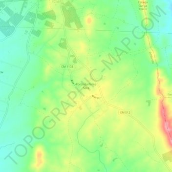
Name: Foros da Fonte Seca topographic map, elevation, terrain.
Location: Foros da Fonte Seca, Redondo, Évora, 7170-034, Portugal (38.60362 -7.55819 38.64362 -7.51819)
Average elevation: 928 ft
Minimum elevation: 784 ft
Maximum elevation: 1,148 ft