
Vals topographic map
Interactive map
Click on the map to display elevation.
About this map
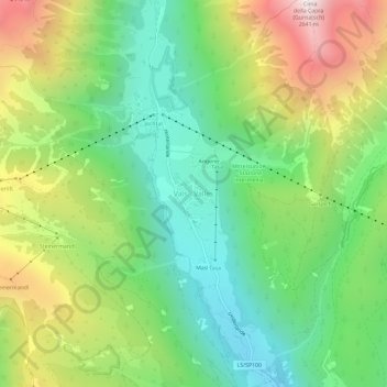
Name: Vals topographic map, elevation, terrain.
Location: Vals, Mühlbach, Eisacktal, Bozen, Trentino-Südtirol, Italien (46.82241 11.60712 46.86241 11.64712)
Average elevation: 5,653 ft
Minimum elevation: 3,967 ft
Maximum elevation: 8,488 ft