Sant Pere Màrtir topographic map
Interactive map
Click on the map to display elevation.
About this map
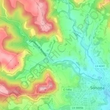
Name: Sant Pere Màrtir topographic map, elevation, terrain.
Average elevation: 2,402 ft
Minimum elevation: 2,139 ft
Maximum elevation: 2,762 ft

Click on the map to display elevation.
Name: Sant Pere Màrtir topographic map, elevation, terrain.
Average elevation: 2,402 ft
Minimum elevation: 2,139 ft
Maximum elevation: 2,762 ft