
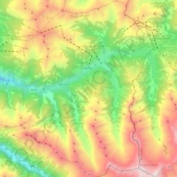
Gemeinde Gerlos topographic map
Interactive map
Click on the map to display elevation.
About this map
Name: Gemeinde Gerlos topographic map, elevation, terrain.
Location: Gemeinde Gerlos, Bezirk Schwaz, Tyrol, 6281, Autriche (47.13869 11.95610 47.27949 12.11112)
Average elevation: 6,270 ft
Minimum elevation: 2,953 ft
Maximum elevation: 10,646 ft