
Santo Tomas topographic map
Interactive map
Click on the map to display elevation.
About this map
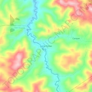
Name: Santo Tomas topographic map, elevation, terrain.
Location: Santo Tomas, Jama, Manabí, Ecuador (-0.36336 -80.33635 -0.32336 -80.29635)
Average elevation: 604 ft
Minimum elevation: 226 ft
Maximum elevation: 1,089 ft