
Le Blanc topographic map
Interactive map
Click on the map to display elevation.
About this map
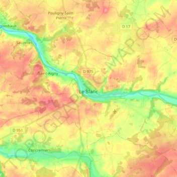
Name: Le Blanc topographic map, elevation, terrain.
Location: Le Blanc, Indre, Centro, Francia metropolitana, 36300, Francia (46.59461 1.01520 46.67557 1.17595)
Average elevation: 364 ft
Minimum elevation: 226 ft
Maximum elevation: 476 ft